Horse Creek
21 mi east · US Army Corps of Engineers
Horse Creek Campground is located on the Kaweah River in the foothills of central California's Sierra Nevada Mountains. The Terminus Dam on Kaweah Lake is three miles east of Lemon Cove, CA.
Outdoors
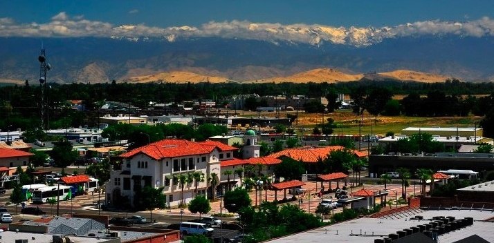
Trails and recreation areas near Visalia open to horseback riding, including horse camps.
Good to know: Check trailer parking and stock water at the trailhead, and whether certified weed-free hay is required.
21 mi east · US Army Corps of Engineers
Horse Creek Campground is located on the Kaweah River in the foothills of central California's Sierra Nevada Mountains. The Terminus Dam on Kaweah Lake is three miles east of Lemon Cove, CA.
27 mi east · Bureau of Land Management
Nestled in the heart of the Sierra Nevada foothills, Case Mountain offers a stunning natural escape for outdoor enthusiasts.
29 mi southeast · US Army Corps of Engineers
At the southern end of the Central Valley, this scenic setting with the Sierra Nevada in the background provides great fishing and boating pleasure for the visitor. From Porterville, 5 mi E on CA 190
Map of 14 places loads as you scroll.
Horse Creek Campground is located on the Kaweah River in the foothills of central California's Sierra Nevada Mountains. The Terminus Dam on Kaweah Lake is three miles east of Lemon Cove, CA.
Nestled in the heart of the Sierra Nevada foothills, Case Mountain offers a stunning natural escape for outdoor enthusiasts.
At the southern end of the Central Valley, this scenic setting with the Sierra Nevada in the background provides great fishing and boating pleasure for the visitor. From Porterville, 5 mi E on CA 190
Tule Campground is located at Success Lake in the Sierra Nevada foothills just 8 miles east of Porterville, California. A variety of outdoor recreational activities abound, including boating, kayaking and fishing.
Crystal Springs campground is centrally located in Sequoia and Kings Canyon National Parks in central California's rugged Sierra Nevada range. This mid-sized group campground is at an elevation of 6,500 feet.
Sunset campground is centrally located in Sequoia and Kings Canyon National Parks in central California's rugged Sierra Nevada range. This campground is at an elevation of 6,500 feet.
Huge mountains, rugged foothills, deep canyons, vast caverns, and the world’s largest trees exemplify the diversity of landscapes, life, and beauty here.
Friant Dam on the San Joaquin River, forms Millerton Lake. The dam and lake are features of the Central Valley Project - Friant Division .
NOTICE: Between February 2nd to February 12th, high water flows and potential flow fluctuations are expected in the San Joaquin River below the Kerckhoff Dam. The BLM advises all visitors to stay out of the water during this time.
Parking access onto nearly 1,800 acres of Bureau of Land Management property in this area is provided through an easement from the California Department of Fish and Game.
The Coalinga Mineral Springs National Recreation Trail was designated under the National Recreation Trails System Act in 1981. The trail is located on the scenic southern tip of the Diablo Mountains.
Located within the Alabama Hills National Scenic Area, photographers come from all over the country to capture this amazing view.
The rounded contours of the Alabamas form a sharp contrast between the glacially chiseled ridges of the Sierra peaks to the west. Both geologic features were shaped by the same uplifting occurring 100 million years ago.
Distances are straight-line miles from downtown Visalia. Listings come from Recreation.gov’s federal recreation database; check each official page for hours, fees, fire restrictions and closures before you go.

THINGS TO DO · YOUTUBE SHORT
A recorded Visalia Chamber Oktoberfest visit at nearby Mooney Grove Park. This county-park event video is regional context, not a current event listing or proof of a city-business location.
Watch on YouTube ↗
THINGS TO DO · YOUTUBE SHORT
A creator’s short view of a downtown Visalia Latin-dance gathering. Recorded activity, not confirmation of a current recurring schedule.
Watch on YouTube ↗Horse Creek (US Army Corps of Engineers), about 21 miles east of Visalia as the crow flies. Next are Case Mountain Extensive Recreation Management Area (27 mi) and Success Lake (29 mi).
Based on Visalia’s average highs, October–May. Conditions at higher elevations can be much cooler.
Federal agencies including Bureau of Land Management, US Army Corps of Engineers, National Park Service. Each listing links to its official page for hours, fees, closures and current conditions.