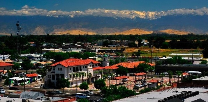
Visalia viewed toward the Sierra Nevada (2011-11-29)

Outdoors

Picnic spots near Visalia

Day-use and picnic areas near Visalia on public land, from quick drives to full-day outings.

11picnic areas
19 mito the closest
4within 30 miles
February–May, October, Novemberbest months

Good to know: Group picnic sites can often be reserved; fire rules change with the season, so check before bringing a grill.

Closest picks

1

Kaweah Lake

19 mi east · US Army Corps of Engineers

One hour SE of Fresno in the rugged foothills of the Sierra Nevada. High mountains provide an exciting background for fishing and boating at this popular park, located on the main southern route into Sequoia-Kings Canyon National Park.
2

Case Mountain Extensive Recreation Management Area

27 mi east · Bureau of Land Management

Nestled in the heart of the Sierra Nevada foothills, Case Mountain offers a stunning natural escape for outdoor enthusiasts.

3

Success Lake

29 mi southeast · US Army Corps of Engineers

At the southern end of the Central Valley, this scenic setting with the Sierra Nevada in the background provides great fishing and boating pleasure for the visitor. From Porterville, 5 mi E on CA 190

Map of all 11 places

Map of 11 places loads as you scroll.

Within 30 miles (4)

19 mi east · US Army Corps of Engineers

Kaweah Lake

One hour SE of Fresno in the rugged foothills of the Sierra Nevada. High mountains provide an exciting background for fishing and boating at this popular park, located on the main southern route into Sequoia-Kings Canyon National Park.

  • Biking
  • Boating
  • Hiking
  • Nature education
  • Picnicking
  • Water sports
  • Wildlife viewing

27 mi east · Bureau of Land Management

Case Mountain Extensive Recreation Management Area

Nestled in the heart of the Sierra Nevada foothills, Case Mountain offers a stunning natural escape for outdoor enthusiasts.

  • Biking
  • Hiking
  • Horseback riding
  • Picnicking
  • Wildlife viewing

29 mi southeast · US Army Corps of Engineers

Success Lake

At the southern end of the Central Valley, this scenic setting with the Sierra Nevada in the background provides great fishing and boating pleasure for the visitor. From Porterville, 5 mi E on CA 190

  • Boating
  • Camping
  • Fishing
  • Horseback riding
  • Nature education
  • Picnicking
  • Water sports
  • Wildlife viewing

29 mi southeast · US Army Corps of Engineers · Campground

Tule

Tule Campground is located at Success Lake in the Sierra Nevada foothills just 8 miles east of Porterville, California. A variety of outdoor recreational activities abound, including boating, kayaking and fishing.

  • Accessible Swimming
  • Amphitheater
  • Backpacking
  • Biking
  • Birding
  • Boating
  • Camping
  • Canoeing

30 to 75 miles (7)

35 mi north · US Army Corps of Engineers

Pine Flat Lake

Less than an hour east of Fresno in the Sierra and Sequoia National Forests. The scenic and rugged Kings River Canyon is the location of this beautiful park where fishing, boating, and waterskiing are all available.

  • Boating
  • Camping
  • Fishing
  • Hiking
  • Picnicking
  • Water sports
  • Wildlife viewing

41 mi south · Bureau of Reclamation

Lake Woollomes

8 a.m. to 5 p.m., Monday through Friday. County-operated park open 5 a.m. to 10 p.m. daily.

  • Boating
  • Fishing
  • Picnicking

49 mi northeast · National Park Service

Sequoia & Kings Canyon National Parks

Huge mountains, rugged foothills, deep canyons, vast caverns, and the world’s largest trees exemplify the diversity of landscapes, life, and beauty here.

  • Camping
  • Climbing
  • Fishing
  • Hiking
  • Horse Camping
  • Horseback riding
  • Picnicking
  • Wildlife viewing

50 mi northwest · Bureau of Reclamation

Millerton Lake

Friant Dam on the San Joaquin River, forms Millerton Lake. The dam and lake are features of the Central Valley Project - Friant Division .

  • Biking
  • Boating
  • Camping
  • Climbing
  • Fishing
  • Hiking
  • History
  • Horseback riding

54 mi north · Bureau of Reclamation

San Joaquin River Gorge Special Recreation Management Area

The San Joaquin River Gorge SRMA is located at the upper portion of Millerton Lake and is accessed through the town of Auberry, CA. The area is managed by Bureau of Land Management (BLM) with trail heads for the San Joaquin trail.

  • Biking
  • Camping
  • Climbing
  • Fishing
  • Hiking
  • History
  • Picnicking
  • Ranger programs

62 mi northwest · US Army Corps of Engineers

Hensley Lake

Less than an hour drive northeast of Fresno in the foothills of the Sierra Nevada enroute to Yosemite National Park. Lake activities include water skiing, fishing, swimming, horseback riding, mountain biking, hiking, and camping.

  • Boating
  • Camping
  • Fishing
  • Hiking
  • Nature education
  • Picnicking
  • Water sports
  • Wildlife viewing

71 mi northwest · US Army Corps of Engineers

Eastman Lake

Just one hour north of Fresno in the Sierra Nevada foothills. Rolling oak-covered hills provide a scenic and restful setting for fishing, boating, and hiking.

  • Boating
  • Camping
  • Fishing
  • Nature education
  • Picnicking
  • Water sports
  • Wildlife viewing

Distances are straight-line miles from downtown Visalia. Listings come from Recreation.gov’s federal recreation database; check each official page for hours, fees, fire restrictions and closures before you go.

Get outside around Visalia

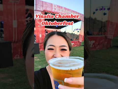
Things to do in Visalia, CA: the Visalia Chamber Oktoberfest at Mooney Grove Park! 🍻🍕🪓 video thumbnail

THINGS TO DO · YOUTUBE SHORT

Things to do in Visalia, CA: the Visalia Chamber Oktoberfest at Mooney Grove Park! 🍻🍕🪓

A recorded Visalia Chamber Oktoberfest visit at nearby Mooney Grove Park. This county-park event video is regional context, not a current event listing or proof of a city-business location.

Watch on YouTube ↗
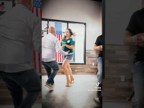
Tuesday Nights in Downtown Visalia video thumbnail

THINGS TO DO · YOUTUBE SHORT

Tuesday Nights in Downtown Visalia

A creator’s short view of a downtown Visalia Latin-dance gathering. Recorded activity, not confirmation of a current recurring schedule.

Watch on YouTube ↗

More outdoors near Visalia

Questions

Where is the closest place for picnic spots near Visalia?

Kaweah Lake (US Army Corps of Engineers), about 19 miles east of Visalia as the crow flies. Next are Case Mountain Extensive Recreation Management Area (27 mi) and Success Lake (29 mi).

When is the best time for picnic spots near Visalia?

Based on Visalia’s average highs, February–May, October, November. Conditions at higher elevations can be much cooler.

Who manages these places?

Federal agencies including US Army Corps of Engineers, Bureau of Reclamation, Bureau of Land Management. Each listing links to its official page for hours, fees, closures and current conditions.

Visalia AI

Your Visalia local guide
Hey there!

I'm Visalia AI. Ask about neighborhood food, independent shops, local history or planning a visit.

AI recommendations may be inaccurate. Verify hours and prices. Questions are processed by Cloudflare. Privacy